13 November 2026
How Hosted Drone Data Simplifies Repeated Site Monitoring
Presented by @aboveground
What Is Time-Series Drone Data and Why Does It Matter?
When you fly a drone over a site once, you get a snapshot. That single flight tells you what the ground looks like at that moment. But many real-world questions are about change: is the construction project on schedule? Is the stockpile shrinking or growing? Did the drainage pattern shift after the last storm? To answer those questions you need time series drone data, a sequence of captures of the same area taken at regular intervals, aligned so you can compare them directly.
Time series data is the foundation of repeat site monitoring. Without it, each flight is an isolated event. With it, you can overlay an orthomosaic from last month on top of this month’s, toggle between dates in a map viewer, and see exactly where the ground surface has changed. The challenge is managing all those files, keeping them organised, and making them accessible to everyone who needs them. That is where hosted drone data comes in.
What Hosted Drone Data Actually Means
Hosted drone data simply means that your aerial imagery, point clouds, and project reports live on a server you can reach through a browser, rather than on your laptop or a hard drive. The hosting service handles the storage, the processing, and often the visualisation layer as well. You upload raw images or processed outputs; the platform keeps everything in one place and lets you view, annotate, and share the results without installing special software.
For repeat monitoring, this setup solves several practical problems at once. First, it keeps every flight in a single project folder, so you never have to hunt through old drives for the orthomosaic from three months ago. Second, it lets you layer those flights in a time series view, often with a slider that moves from the earliest date to the latest. Third, it makes collaboration straightforward: a site manager, an engineer, and a client can each log in, look at the same data, and add annotation markers where they see issues.
How Time Series Data Changes the Way You Monitor a Site
With a hosted platform, the process of repeat monitoring becomes a routine, not a project. You fly the site on a schedule, weekly, monthly, or at key milestones. Each flight produces a set of files: raw images, an orthomosaic, a point cloud, maybe a volume calculation. You upload those files to the same project on the hosting service. The platform aligns the new data with the previous sets, often using ground control points or the geotags already embedded in the images.
Once the upload is complete, you open the map viewer and see the latest layer sitting on top of the earlier ones. You can switch between dates, measure distances, compare elevation profiles, and export side-by-side views for a project report. The time series becomes a visual record that tells the story of the site: where earth moved, where water pooled, where vegetation changed, where structures rose.
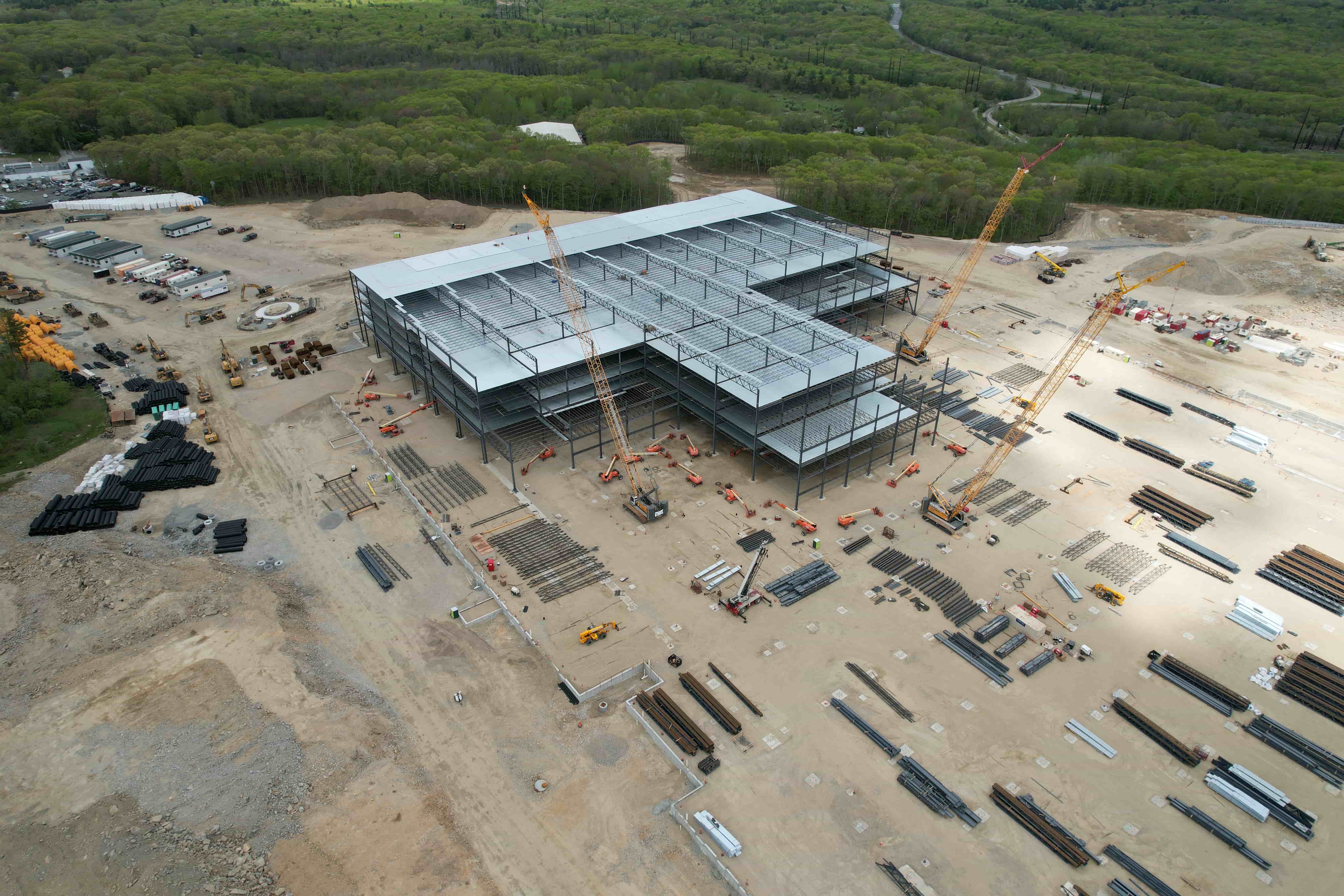
This kind of visual comparison is far more powerful than looking at two separate PDFs or trying to overlay images in a photo editor. The hosted platform keeps the spatial reference intact, so every measurement you make on one date is directly comparable with the same measurement on another date. That consistency is what makes time series drone data genuinely useful for decision making.
What to Look for in a Hosted Platform for Repeat Monitoring
Not every data hosting service is built for time series work. Some are designed for a single flight and a single deliverable. Others treat each upload as an independent project, making it hard to compare across dates. For repeat site monitoring, you need a few specific capabilities:
- A project structure that keeps multiple flights under one roof, with clear date stamps on each.
- A map viewer that supports layer toggling or a time slider, so you can move between dates smoothly.
- Tools for annotation that persist across dates, so you can mark a feature once and see how it changes over time.
- Support for the file types you produce: orthomosaics, point clouds, and any processed outputs your workflow generates.
- Role-based access so you can give different permissions to the pilot, the site team, and the client.
When these pieces are in place, the platform becomes more than a storage bin, it becomes a monitoring dashboard. You open it each week, upload the new data, and within minutes you can see what has changed since the last visit. That speed is what makes repeat monitoring practical for busy teams.
Practical Benefits for Pilots and Their Clients
For a drone pilot who does regular site inspections, hosted data removes a lot of friction. You no longer need to manage file transfers, worry about version control, or create a separate report for every flight. The platform handles the organisation. You upload, the system processes the images into an orthomosaic or point cloud, and the client can view the results immediately. That saves time on both sides.
For the client, the construction manager, the quarry operator, the environmental consultant, hosted time series data means they can see the site’s history in one place. They can go back to an earlier date, check a measurement, and compare it with today’s numbers without asking the pilot for a re-export. They can also add annotation markers to flag areas of concern, and those markers stay attached to the correct date in the time series. Over months of monitoring, that record becomes a valuable asset for reporting, compliance, and planning.
Where Hosted Data Fits into a Pilot’s Workflow
A typical repeat monitoring job might run for six months, with flights every two weeks. That is twelve flights, each producing several gigabytes of data. Without a hosted platform, the pilot ends up with a dozen folders on a hard drive, separate exports for each flight, and a lot of manual work to create comparison views for the client. With a hosted platform, the pilot uploads each flight to the same project, the system aligns the new data automatically, and the client sees the growing time series without any extra effort from the pilot.
Some platforms also handle the processing step. You upload raw images, and the service stitches them into an orthomosaic and generates a point cloud. That saves the pilot from running photogrammetry software on their own machine, which can be slow and ties up a computer for hours. The hosted processing runs in the background, and the results appear in the map viewer when they are ready.
For pilots working through a service like National Drone Services, this kind of integrated workflow is especially useful. The platform connects capture work with data delivery, so the pilot can focus on flying well and let the hosting side handle the processing, visualisation, and reporting. That means the client gets a polished project report with a time series view, annotations, and measurements, all from the same system where the data lives.
Common Pitfalls to Avoid When Setting Up Repeat Monitoring
Even with a good hosted platform, repeat monitoring works best when you plan ahead. A few mistakes can undermine the time series before it starts:

- Inconsistent flight paths. If you fly a different route each time, the images won’t overlap the same way, and the orthomosaic may not align well. Use a flight-planning app to save the mission and repeat it exactly.
- Ignoring ground control. Without permanent ground markers or a known reference point, each flight’s georeferencing can drift. Place a few visible targets on site and survey their positions once; use them in every flight to keep the time series aligned.
- Uploading raw files only. A hosted platform can process raw images, but if you also upload the processed orthomosaic, you give the client the best-quality layer to compare. Check your platform’s recommendation for file types.
- Skipping the annotation step. The real value of a time series is in the comparisons you draw from it. Take a few minutes after each flight to add annotation markers where you see change. Those notes become the narrative of the project report.
These steps are simple, but they make a big difference in how useful the time series becomes as the monitoring period extends.
What the Future of Site Monitoring Looks Like
Hosted drone data is not a new idea, but its application to repeat monitoring is still maturing. As more pilots and clients adopt the workflow, the platforms are adding features that make time series analysis more powerful: automated change detection, volume calculation history, and integration with other data sources like weather records. The data that pilots collect today will be used not just for this month’s report, but as a baseline for future comparisons.
For anyone involved in site monitoring, whether you fly the drone, manage the project, or make decisions based on the data, understanding how time series drone data works and why it benefits from a hosted platform is a practical skill. It turns a collection of individual flights into a coherent story of the site’s evolution. And that story is what clients are paying for, even if they do not always say it in those words.
National Drone Services provides a platform that supports this entire workflow, from capture to delivery, making it easier for pilots to offer repeat monitoring as a service and for clients to see the value in a consistent, comparable dataset.